I am currently switching to Mapfactor Navigator mainly to use now also offline Open Street Maps.
The main problem is to get all those old waypoints converted. Unfortunately it is confusing what developers but users are reporting on different forums. MN obviously used different tools at different times and even different directories.
Before you start, get the most recent version of GPSBABEL 1.5.1 (which runs natively on OSX) as well as DIGGER 12. To run Digger on OSX, install WINE and move the DIGGER 12 binaries to the internal C drive, as it will crash otherwise. Also put a nice 200×200 PNG with a circle and a transparent background into the same directory. The Android directory for the Mapfactor Navigator files is
SDdisk/Android/data/com.mapfactor.navigator/files/navigator
where the favourites.xml sits. favourites.xml is a file that holds the POIs and can be edited by any text editor. Just enter a few waypoints, open it on the Mac to see the file structure.
The /data directory holds the *.mca files. These are binary files for the permanent overlay. If you don’t need to see you POIs all the time, just forget about mca and digger and stick to gpsbabel to convert your gpx files as shown below.
 .
.
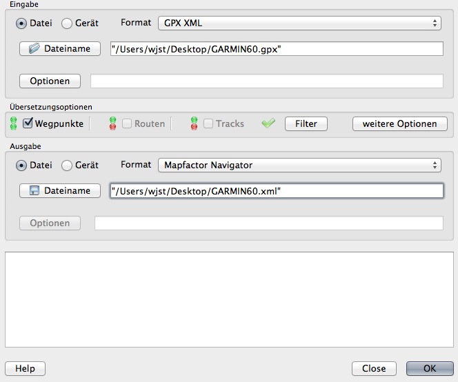
The resulting xml file can be used for cut & paste into favourites.xml, and you are done.
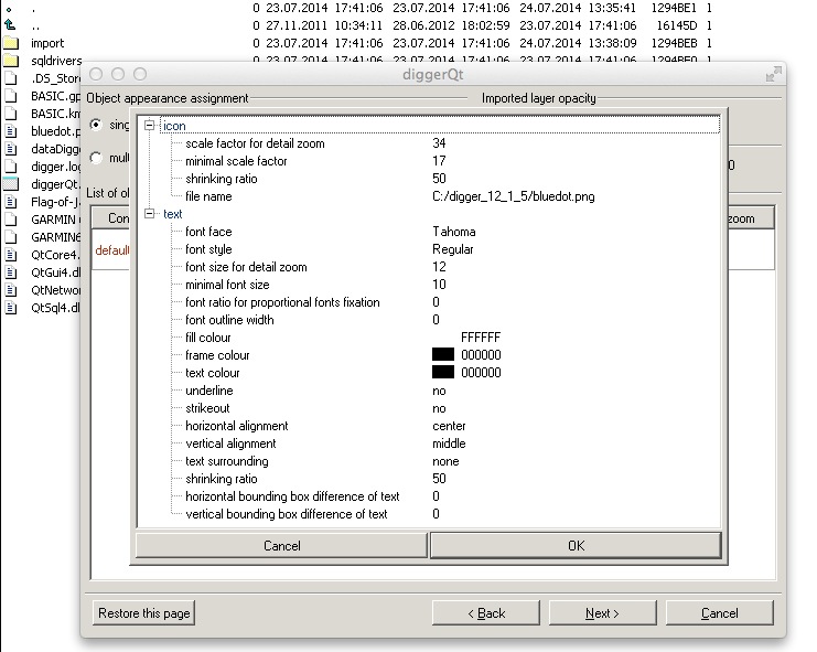
The more complicated part comes with digger. The first 3 screens of this tool are quite straightforward while the “NEXT” button on the last screen is grayed out. And no help in sight! Only by an instructional video I came around that page: clicking on test in the first line and editing the POI thumbnail location, lets you do the final conversion.
 .
.
HTH.