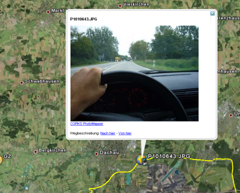
Have you ever ever wondered how these nice photo tracks in Google Earth work?
After spending hours of try & error, here is my recommendation if you can record NMEA stream on your GPS device and JPG on your camera. No hacking, no conversion, no scripts, just a quick & intuitive way by freely available software.
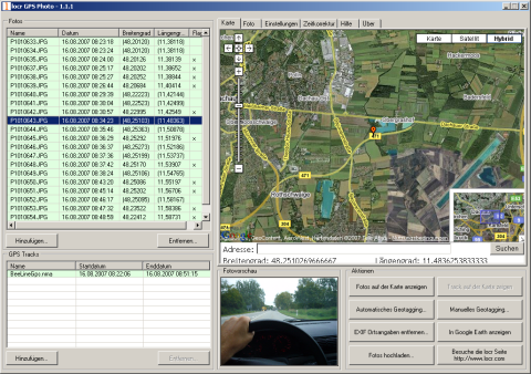
Adjust your camera & GPS to be absolutely synchronous. After data recording copy all your files into a single directory and let Locr GPS Photo propose a GPS position for all photos. Correct positions in the map window if necessary.
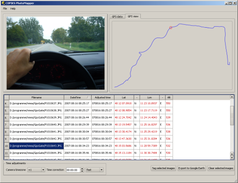
Then fire up COPIKS Photo Mapper, load photos plus track and export all together as a KMZ file.
You are done!